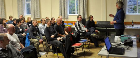
Our courses are normally run in and around the Greater Manchester area (moors above Bolton, Bury, Oldham and Rochdale) and the West Pennine Moors of Lancashire (Blackburn, Burnley, Rossendale) area. For groups and organisations we can deliver the course at a suitable venue near you.
BRONZE AWARD
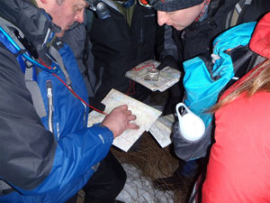
On completion of this award, participants will be able to plan and follow simple walks in the countryside mainly on paths and tracks.
Syllabus - The Learning Outcomes
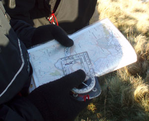
- Understand the nature of a map as a two dimensional plan.
- Understand how to use map symbols and scales, on a variety of maps.
- Take a 6 figure grid reference for any given position and also locate such a reference on the map.
- Orientate the map with and without a compass.
- Use the orientated map to identify land features and indicate direction of travel.
- Choose simple navigation strategies and routes.
- Use linear features (e.g. paths and tracks) as handrails in simple navigation exercises.
- Estimate distance on both map and ground.
- Using a basic understanding of contours, match major landforms like hills and valleys to their map representation.
- Plan a safe, suitable walk.
- Relocate using simple techniques on paths and other handrails.
- Understand access rights and responsibilities.
- Demonstrate an awareness of local and national access issues and access legislation.
- Demonstrate knowledge of the Countryside Code, and of procedures to be followed in the event of an emergency.
Assessment Guidance Notes:
Candidates will be assessed on their ability to navigate using a variety of simple line features in open countryside and/or woodland.
The assessment route would normally include a number of points on distinct features which require the navigator to use a variety of line features. The assessment route would normally have frequent changes in direction to assess map orientation skills. The practical assessment will be undertaken over a distance of 3-5km dependent on terrain. Practical assessment will be reinforced by questions to the candidate on the basic skills of navigation, route planning, selection and safety. This may be done orally or in a written format. Maximum assessment ratio 1:6.
National Navigation Award Scheme - Bronze Course Dates
17 - 18 February 2025
15 - 16 March 2025
24 - 25 April 2025
By arrangement for 2 or more
SLIVER AWARD
On completion of this award participants will be able to plan and follow walks in the countryside away from paths and tracks.
Syllabus - The learning outcomes: (additional to those of the Bronze Award)
- Devise a strategy for a navigational stage, to break it down into 'coarse' and 'fine' navigation and to use clear features en route to check that they are 'on course'.
- Understand and apply the following components of a navigational strategy 'aiming off', 'attack points', 'collecting features', simplifying navigation, and apply them in varying terrain.
- Demonstrate an understanding of contour features, both large and small, on the map and on the ground.
- Demonstrate an understanding of the navigation physical and factors affecting route choice.
- Judge distance accurately on the map and on the ground.
- Plan a safe walk or route involving Silver award skills and strategies.
- Employ simple relocation strategies when lost.
- Use a compass to follow accurate bearings and to check the direction of footpaths or other linear features on both map and ground.
- Demonstrate knowledge of the effects of fatigue and physical discomfort brought on by navigating in demanding countryside and/or extreme weather condition.
- Knowledge of basic first aid is also expected.
- Demonstrate knowledge and application of the Countryside Code and current access legislation as for the Bronze level together with an appreciation of basic environmental factors in mixing 'man with nature' (e.g. footpath erosion and methods of dealing with it), and responsibilities towards other countryside interests like farming, forestry and conservation.
Assessment Guidance Notes:
The candidates will be assessed on their ability to plan an appropriate route and navigate using a variety of navigation strategies such as aiming off, attack points, collecting features, simplifying navigational legs and choosing appropriate routes. The assessment route would normally include a number of distinct contour features which require the navigator to use a wide range of navigational strategies.
The assessment route would normally use a variety of countryside to require choice of route, having regard to the effect of terrain, etc. The practical assessment will be undertaken over a distance of 5 - 8km. Practical assessment will be supplemented by questions to the candidate. Candidates will demonstrate their ability to plan a route, and their understanding of the interaction between the land, countryside users and conservation. This can be done orally or in a written format. Maximum assessment ratio 1:6.
National Navigation Award Scheme - Silver Course Dates
1- 3 March 2025
28 - 29 April 2025
By arrangement for 2 or more
GOLD AWARD
On completion of this award, participants will be able to plan and follow routes in any open countryside, forest, or hill environment.
Syllabus - The learning outcomes:
- Show confidence in the use of the skills detailed for the Bronze and Silver awards in open countryside, forests and hill environments
- Demonstrate the use of contours, to identify landforms (e.g. hilltops, valleys, spurs, re-entrants and knolls) and utilise them as the prime method of navigation.
- Demonstrate use of ridges and valleys as reliable handrails and the size and relationship of contour features, (e.g. a series of knolls) and use them for micro navigation to specific locations.
- Demonstrate the use of distance judgement, compass skills and continuous contact (by frequent checking) in complicated areas.This involves the use of both map to ground and ground to map techniques, the selection of appropriate techniques for each situation, and the integration of these into a navigation strategy.
- Demonstrate the ability to plan a safe walk or route in open country in line with set criteria of duration, difficulty and objectives. This must involve "Gold" skills and strategies and may be used by the candidate for practice prior to assessment if appropriate.
- Demonstrate an understanding of the special physical and navigation demands posed by hill and moorland terrain, poor weather conditions, daylight hours and the effects of fatigue and discomfort on decision making and execution of a selected route. This includes awareness of the effects of heat and cold.
Guidance Notes - Gold Training
The candidate must achieve confidence in the application of the gold level syllabus outlined above.
Training routes will use a variety of progressively more complicated terrain to allow practise of continuous contact using map to ground and ground to map techniques.
Attention must also be paid to the candidate's ability to use large contour features like ridges, valleys or spurs as a means of locating smaller features e.g. following a long valley up towards a small marsh location at its head could give the attack point strategy a contour dimension. A ridge route to a summit could be the best choice rather than a direct approach up a steep and rocky hillside.
Practice terrain should be chosen to allow the application of route choice and flexible decision making when circumstances demand it (e.g. bad weather or fitness/ability strategies and escape routes).
Navigation in poor visibility i.e. mist or darkness is wherever possible to be part of the training and / or assessment of the Gold award.
The duration of training at Gold level should is a minimum of 12 hours and would normally cover all aspects of the syllabus.
Maximum ratio.1:4
Guidance Notes - Gold Assessment
Assessment of the Gold award is to be taken at a later date than the training, in order for candidates to have sufficient opportunity to practise their skills before presenting themselves for Gold assessment.
In addition to an oral or written examination, the candidate will be assessed on a practical exercise in which the candidate follows a route in terrain with complex contour features.
The practical assessment duration will be a maximum of 6 hours with a maximum ratio of 1:4.
Candidates will demonstrate the ability to plan a safe walk with flexible options and know how to re-plan en-route.
The assessor will judge whether the routes taken by candidates are the most effective taking into account height gain and loss as well as underfoot physical demands, whether the candidate uses navigation strategies with confidence and skill and how well their level of concentration is adjusted to the difficulty of navigation.
The assessor will make judgements regarding route awareness, checking progress against time, assessing the route ahead and flexibility in changing the route as circumstances such as weather, terrain, time, daylight, ability / fitness, etc dictate.
As with Bronze and Silver, the assessment can be used as a teaching basis for future attempts, if the first attempt does not reach the standards required.
Where inclement weather or testing conditions have not been encountered during the practical assessment, candidates should be questioned to judge their awareness of safety and physical factors involved in remote navigation with special attention to clothing, equipment, basic first aid, flexible decision making, escape route, shortening a route, emergency procedures etc.
The length of the practical assessment will depend on the type of map and terrain, but candidates at this level are expected to be appropriately fit to cope with the demands of the terrain and duration of the day. The distance will normally be between 6 - 10 km in suitable forest, fell or moorland that has no major terrain hazards en route.
National Navigation Award Scheme - Gold Course Dates
7 - 8 April 2025
By arrangement for 2 or more
Please call for additional course dates.